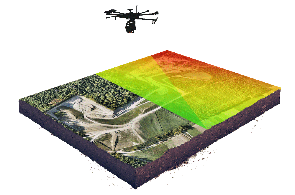
Aerial Surveying & Mapping

Drone survey is the use of a drone or Unmanned Aerial Vehicle (UAV) to capture aerial data with downward facing sensors such as lidar, RGB or multispectral cameras as the payload. Surveying with a drone has offered a huge potential to the world of GIS. With a drone, one can carry out topographic surveys of the same quality as the highly accurate measurements that are collected using the traditional methods at faster speeds or rather using shorter periods which in turn reduces costs of carrying out the survey and man power required for such a task. Photos of the ground of the site or Area of Interest (AOI) are taken several times from different angles and each image is geotagged/ tagged with coordinates.

Benefits

i. Reduces field time and survey costs

ii. Provides accurate and exhaustive data

iii. Can easily map inaccessible areas

Example uses of drones in Surveying and mapping:


Lidar Technology and Topographic Mapping-based LiDAR

LiDAR stands for Light Detection and Ranging and is a remote sensing method that is more and more being used in combination with drones. It uses scanners while flying, shooting out pulses of light, travelling to the ground, penetrating through vegetation, getting down to the ground and returning to the scanner. Using the speed of light, measuring the two-way travel time from the beam of light from the scanner, oner can measure the distance to the surface of the earth and build a 3D point cloud. Lidar data from drones is very accurate as it utilizes direct georeferencing through a GNSS and Inertial Measurement Unit (IMU) as opposed to photogrammetry where multiple control points are used to guarantee data accuracy.
 
Why collect Lidar data from drones?
The main reasons for collecting Lidar from drones are time, money, safety and the level of detail that is required.


Lidar scanning by a drone

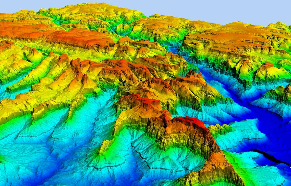
Terrain model resulting from lidar data


Land Surveying and Cartography

Sensors on the drones generate high resolution Ortho mosaics and detailed 3D models of the AOI. This enables high accuracy cadastral maps to be produced quickly and easily


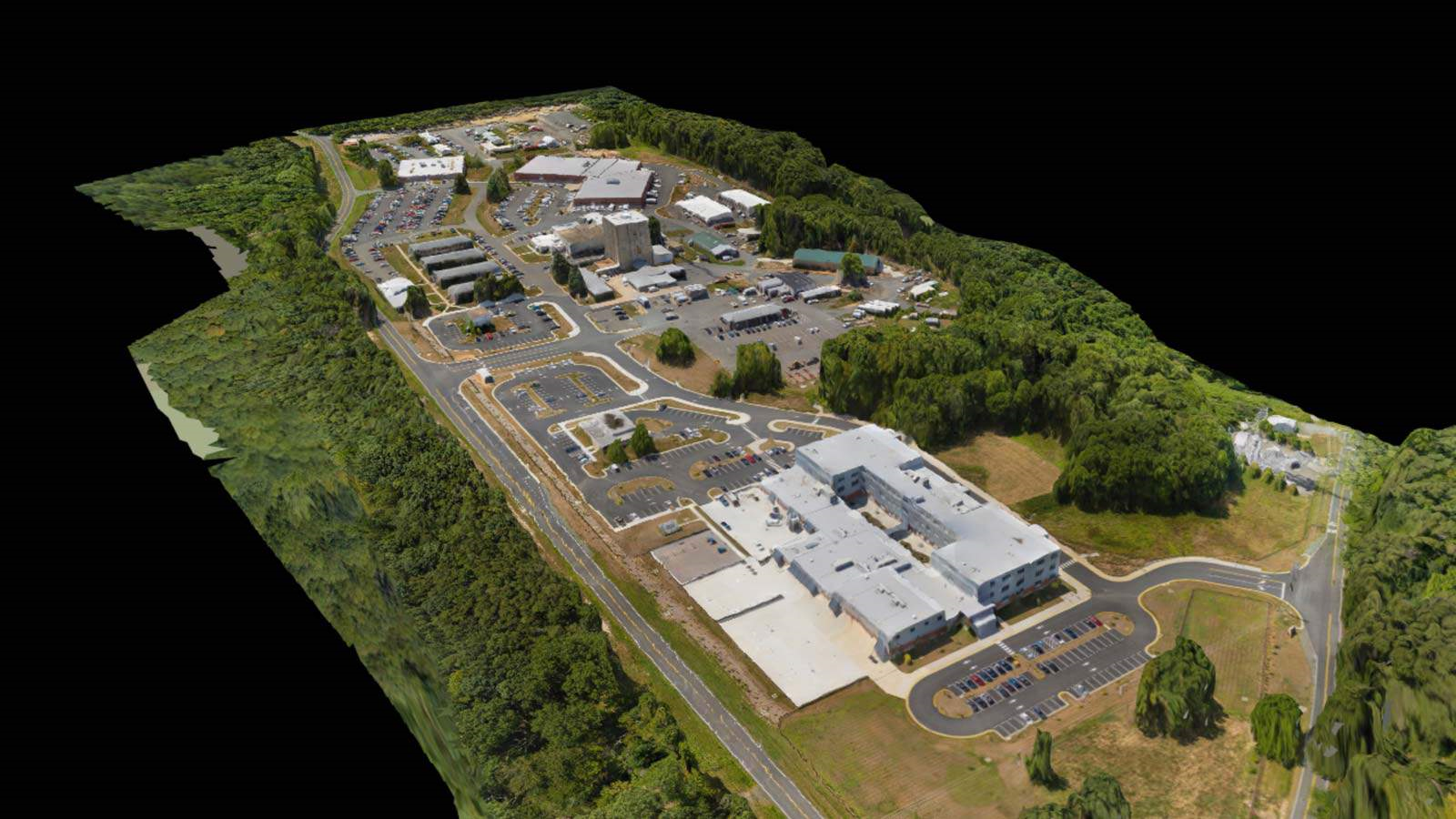
3D model generated from drone survey


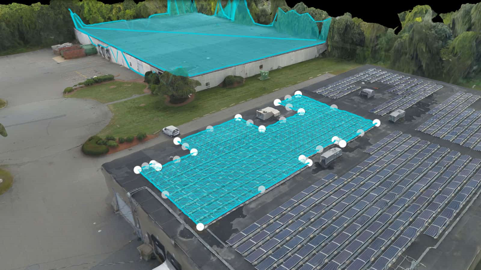
Land Management and Development

Site scouting, planning and design for construction of roads buildings and utilities from the high resolution photographs generated used to produce contours which are key in design work and construction.


Precise Measurements

High resolution orthophotos enable surveyors to perform highly accurate distance and surface measurements.


Slope Monitoring

With automated GIS analysis, it is possible to extract slope measurements from Digital Terrain Models (DTMs) and Digital Surface Models (DSMs)generated by drone imagery. This is useful for landslide mitigation and prevention.


Urban Planning

Large amounts of up to date data can be collected in a short period of time with far less personell. These images can be used to examine existing social and environmental conditions of the AOI and consider the impact of different scenarios.


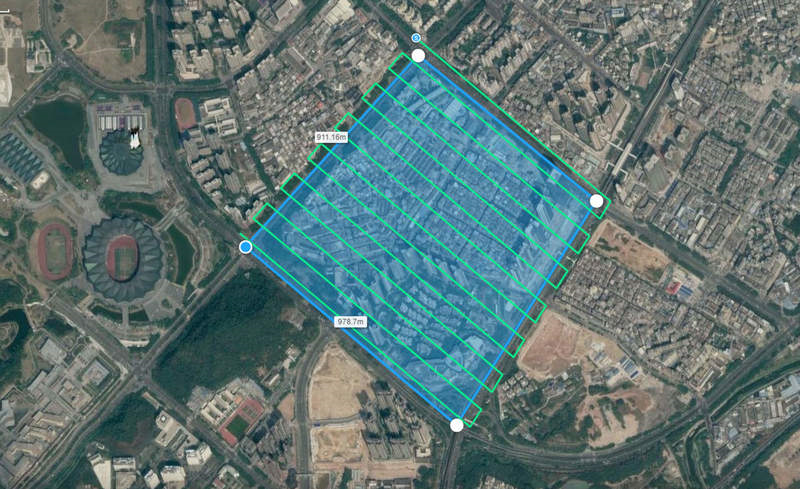
  • Drone flight plan to photograph a section of a city for urban planning

    How accurate is drone surveying?

    1. It depends on the performance and type of the drone;
    2. Quality of its components ;
    3. Camera resolution;
    4. The height at which the drone flies;
    5. Vegetation and;
    6. Technology used to geolocate the aerial images.

    Absolute accuracy

    • It depends on the performance and type of the drone;


WhatsApp Support
Maggie
Sales
Please reach us through WhatsApp for any queries or questions.