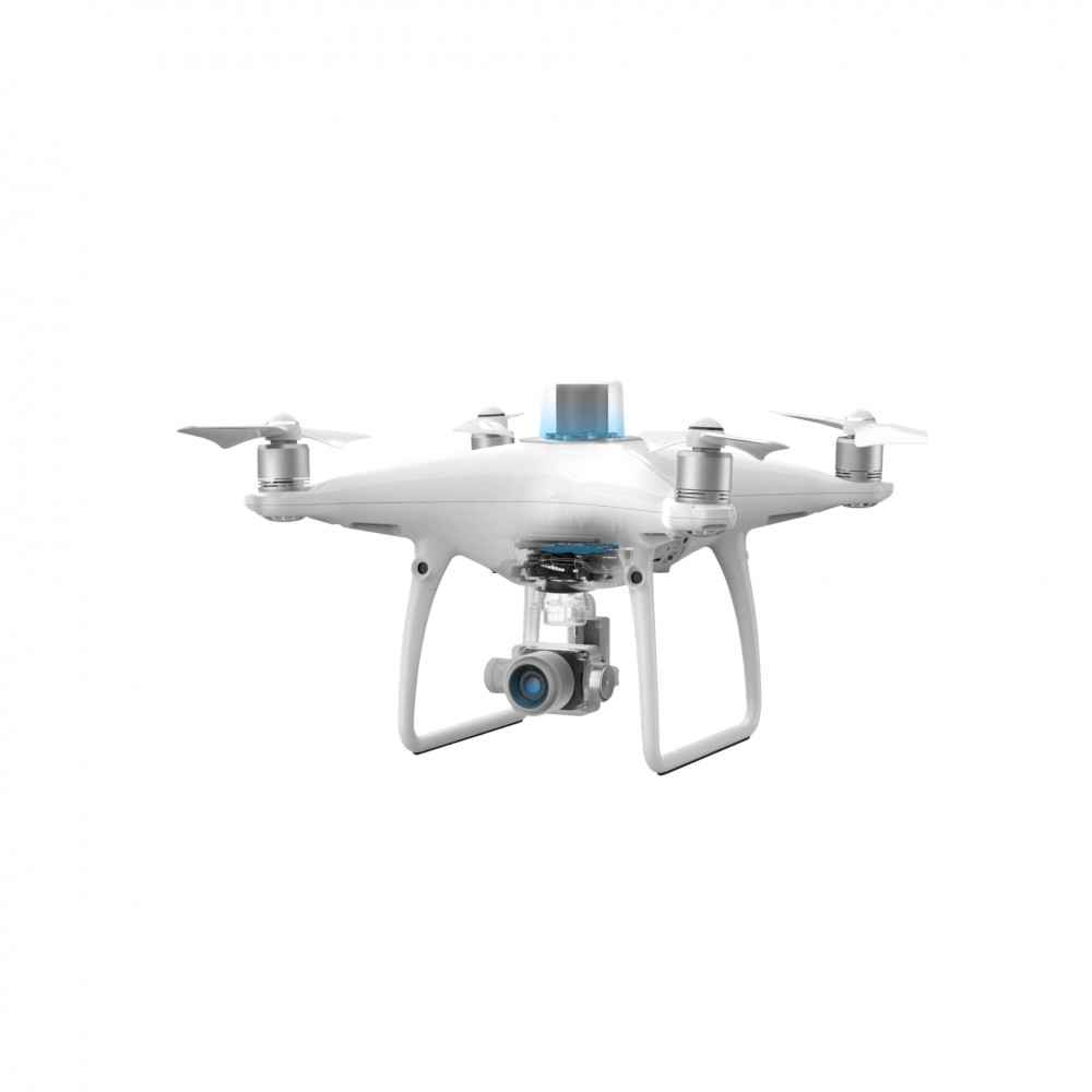
PHANTOM 4 RTK COMBO

PHANTOM 4 RTK COMBO

Brand: DJI
Product Code: PHANTOM 4 RTK COMBO
Availability: Available on Back Order
Viewed 1746 times

Product Description

Aircraft

Takeoff Weight 1391 g
Diagonal Distance 350 mm
Max Service Ceiling Above Sea Level 19685 ft (6000 m)
Max Ascent Speed 6 m/s (automatic flight); 5 m/s (manual control)
Max Descent Speed 3 m/s
Max Speed 31 mph (50 kph)(P-mode)
36 mph (58 kph)(A-mode)
Max Flight Time Approx. 30 minutes
Operating Temperature Range 32° to 104° F (0° to 40℃)
Operating Frequency 2.400 GHz to 2.483 GHz (Europe, Japan, Korea)
5.725 GHz to 5.850 GHz (United States, China)
Transmission Power (EIRP) 2.4 GHz
CE (Europe) / MIC (Japan) / KCC (Korea) :< 20>
5.8 GHz
SRRC(China) / FCC(United States)/NCC(Taiwan,China):< 26>
Hover Accuracy Range RTK enabled and functioning properly:
Vertical:±0.1 m;Horizontal:±0.1 m

RTK disabled
Vertical:±0.1 m(with vision positioning );
±0.5 m(with GNSS positioning)
Horizontal:±0.3 m(with vision positioning);
±1.5 m(with GNSS positioning)
Image Position Offset The position of the camera center is relative to the phase center of the onboard D-RTK antenna under the aircraft body's axis:(36, 0, and 192 mm) already applied to the image coordinates in Exif data. The positive x, y, and z axes of the aircraft body point to the forward, rightward, and downward of the aircraft, respectively.

Mapping Functions

Mapping Accuracy ** Mapping accuracy meets the requirements of the ASPRS Accuracy Standards for Digital Orthophotos Class Ⅲ
** The actual accuracy depends on surrounding lighting and patterns, aircraft altitude, mapping software used, and other factors when shooting.
Ground Sample Distance(GSD) (H/36.5) cm/pixel,
H means the aircraft altitude relative to shooting scene (unit: m)
Data Acquisition Efficiency Max operating area of approx. 1 km⊃2; for a single flight(at an altitude of 182 m, i.e., GSD is approx. 5 cm/pixel, meeting the requirements of the ASPRS Accuracy Standards for Digital Orthophotos Class Ⅲ

Vision System

Velocity Range ≤31 mph(50 kph) at 6.6 ft(2 m) above ground with adequate lighting
Altitude Range 0-33 ft(0 - 10 m)
Operating Range 0-33 ft(0 - 10 m)
Obstacle Sensing Range 2-98 ft(0.7-30 m)
FOV Forward/Rear: 60° (horizontal), ±27° (vertical)
Downward: 70° (front and rear), 50° (left and right)
Measuring Frequency Forward/Rear:10 Hz;
Downward: 20 Hz
Operating Environment Surfaces with clear patterns and adequate lighting(> 15 lux)

Camera

Sensor 1" CMOS; Effective pixels: 20 M
Lens FOV 84°;8.8 mm / 24 mm(35 mm format equivalent:24 mm);
f/2.8 - f/11, auto focus at 1 m - ∞
ISO Range Video:100-3200(Auto)
100-6400(Manual);

Photo:100-3200(Auto)
100-12800(Manual)
Mechanical Shutter Speed 8 - 1/2000 s
Electronic Shutter Speed 8 - 1/8000 s
Max Image Size 4864×3648(4:3);
5472×3648(3:2)
Video Recording Modes H.264,4K:3840×2160 30p
Photo Format JPEG
Video Format MOV
Supported File Systems FAT32(≤ 32 GB);
exFAT(> 32 GB)
Supported SD Cards MicroSD, Max Capacity: 128 GB. Class 10 or UHS-1 rating required Write speed≥15 MB/s
Operating Temperature Range 32° to 104° F (0° to 40℃)

Intelligent Flight Battery(PH4-5870mAh-15.2V)

Capacity 5870 mAh
Voltage 15.2 V
Battery Type LiPo 4S
Energy 89.2 Wh
Net Weight 468 g
Charging Temperature Range 14° to 104℉(-10° to 40℃)
Max charging Power 160 W

Intelligent Battery Charing Hub(WCH2)

Input Voltage 17.3 - 26.2 V
Output Voltage and Current 8.7 V,6 A;5 V,2 A
Operating Temperature 41° to 104℉(5° to 40℃)

SDK Remote Controller

Operating Frequency 2.400 GHz to 2.483 GHz (Europe, Japan, Korea)
5.725 GHz to 5.850 GHz (Other countries/regions) 
EIRP 2.4 GHz
CE / MIC / KCC: < 20>
5.8 GHz
FCC / SRRC / NCC: < 26>
Max Transmission Distance FCC / NCC: 4.3 mi (7 km);
CE / MIC / KCC / SRRC: 3.1 mi (5 km)
  (Unobstructed, free of interference) 
Built-in Battery 6000 mAh LiPo 2S 
Operating Current / Voltage 1.2 A @ 7.4 V
Mobile Device Holder Tablets and smartphones 
Operating Temperature 32° to 104° F (0° to 40° C)

Write a review

Note: HTML is not translated!
    Bad           Good

When you order from geoidtechnologies.com, you will receive a confirmation email. Once your order is shipped, you will be emailed the tracking information for your order's shipment. You can choose your preferred shipping method on the Order Information page during the checkout process.

The total time it takes to receive your order is shown below:

The total delivery time is calculated from the time your order is placed until the time it is delivered to you. Total delivery time is broken down into processing time and shipping time.

Processing time: The time it takes to prepare your item(s) to ship from our warehouse. This includes preparing your items, performing quality checks, and packing for shipment.

Shipping time: The time for your item(s) to tarvel from our warehouse to your destination.

Shipping from your local warehouse is significantly faster. Some charges may apply.

In addition, the transit time depends on where you're located and where your package comes from. If you want to know more information, please contact the customer service. We will settle your problem as soon as possible. Enjoy shopping!

WhatsApp Support
Maggie
Sales
Please reach us through WhatsApp for any queries or questions.