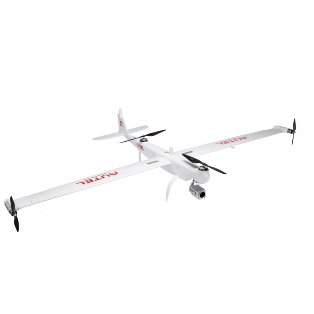
DragonFish lite with Triple sensor

Product Description
| AIRCRAFT | |
| Dimensions | 2.3*1.29*0.46 m (L*W*H) |
| Weight | 7.5 kg (including two batteries, without gimbal) |
| Single Battery Weight | 1.3 kg |
| Max Payload | 1.5 kg |
| Max Takeoff Weight | 9 kg |
| Operating Frequency | 902-928 MHz,2.4000-2.4835 GHz,5.725-5.755GHz |
| EIRP (Equivalent radiated power) | 900MHz FCC:< 30>2.4 GHz FCC:< 30>SRRC/CE/MIC:< 20>5.8 GHz SRRC/FCC:< 30>CE: < 14> |
| Hovering Accuracy (P-mode with GPS) | Vertical: ±0.1 m (Vision System enabled) ±0.5 m (GPS enabled) ±0.1 m (RTK enabled) Horizontal: ±0.3 m (Vision System enabled) ±1.5 m (GPS enabled) ±0.1 m (RTK enabled) |
| RTK Positioning Accuracy | When RTK enabled and fixed: 1 cm+1 ppm (Horizontal) 1.5 cm + 1 ppm (Vertical) |
| Max Angular Velocity | Pitch: 180°/s, Yaw: 60°/s |
| Max Pitch Angle | 20° |
| Max Roll Angle | 35° |
| Max Ascent Speed | Vertical Flight Mode: 4 m/s Fixed Wing Mode: 5 m/s |
| Max Descent Speed (vertical) | Vertical Flight Mode: 3 m/s Fixed Wing Mode: 5 m/s |
| Max Speed | 30 m/s |
| Service Ceiling Above Sea Level | 6000 m |
| Max Flight Time | 120 min |
| Supported Payloads | Dual-Sensor, Triple-Sensor, Multispectral, Third Party Payloads |
| Supported Gimbal Configurations | Fast Disassembly |
| Ingress Protection Rating | IP43 |
| GNSS | GPS+GLONASS+BeiDou+Galileo |
| Operating Temperature | -20°C to 50°C (-4°F to 122° F) |
| GENERAL | |
| Battery | Type: Li-Po Capacity: 8200 mAh Voltage: 11.4 V Energy: 93 Wh Charging time: 120 min |
| Run Time | 3 hrs (Max brightness) 4.5 hrs (Half brightness) |
| Storage Capacity | ROM 16 GB + scalable (TF) |
| Video Output Port | HDMI Port |
| Power Supply Current / Voltage (USB-A port) | 5V / 500m A |
| Operating Temperature Range | -4° to 104° F (-20° to 40° C) |
| Storage Temperature Range | < 1>1-3 months: -4° to 113° F (-20° to 45° C) 3-12 months: -4° to 86° F (-20° to 30° C) |
| Charging Temperature Range | 32° to 113° F (-0° to 45° C) |
| GNSS | GPS+GLONASS+Galileo |
| Dimensions | 319*233*74 mm (antennas folded) 319*398*74 mm (antennas unfolded) |
| Weight | 1987g |
| GNSS RECEIVER | |
| Satellite receiving frequency | Simultaneous receive: GPS: L1, L2, L5 BeiDou: B1, B2, B3 GLONASS: F1, F2 Galileo: E1, E5A, E5B |
| Positioning accuracy | Single Point Horizontal: 1.5 m (RMS) Vertical: 3.0 m (RMS) RTK Horizontal: 1 cm+1 ppm (RMS) Vertical: 1.5 cm+ 1 ppm (RMS) 1 ppm: For every 1 km increase in distance, the accuracy will be 1 mm less. For example, the horizontal accuracy is 1.1 cm when the receiving end is 1 km away from the base station. |
| Positioning update rate | 1 Hz, 2 Hz, 5 Hz, 10 Hz and 20 Hz |
| Cold start | < 40s> |
| Hot start | < 10s> |
| Recapture | < 1s> |
| Initialization reliability | > 99.9% |
| Differential data transmission format | RTCM 2.X/3.X |
| WIFI | |
| Operating frequency | 2.400-2.4835 GHz; 5.125-5.25GHz; 5.650-5.755GHz; 5.725-5.850GHz |
| EIRP (Equivalent radiated power) | 2.400-2.4835 GHz FCC:< 26>SRRC/CE/MIC:< 20>5.125-5.25 GHz FCC/SRRC:<26>5.650-5.755 GHz MIC:< 20>5.725-5.850 GHz SRRC/FCC:< 26>CE:< 14>SRRC/CE/MIC:< 20> |
| Communication distance | Mobile station and aircraft: 30 km (FCC) Mobile station and remote control: 200 m (FCC) (Unobstructed and free of interference, when the mobile station is used as a base station and the distance from the mobile station antenna to the bottom of the tripod is 2 m; and when the difference in height between the remote controller and mobile station is less than 10 m, and when the remote controller is 1.2 m from ground level) |
| ZOOM CAMERA | |
| Effective Pixels | 8MP |
| Zoom | 20x zoom, 12x digital zoom, 240x total magification |
| Aperture | F2.0 (wide) to 3.8 (tele) |
| Photo Resolution | 3840x2160 |
| Photo | JPEG |
| Video Resolution | 3840x2160 1920x1080 |
| Video | MP4 |
| WIDE ANGLE CAMERA | |
| Effective Pixels | 12MP |
| Zoom | 1-8x digital zoom |
| Photo Resolution | 4000x3000 |
| Photo | JPEG |
| Video Resolution | 3840x2160 1920x1080 |
| Video | MP4 |
| THERMAL CAMERA | |
| Infrared camera sensor | Uncooled VOx Microbolometer |
| Sensor Resolution | 640*512 |
| Zoom | 1-8x digital zoom |
| Pixel Pitch | 12μm |
| Spectral Band | 8-14μm |
| Lens | 25mm F1.0 |
| FOV | 17°×14° |
| Photo Resolution | 640*512 |
| Photo | JPEG |
| Video Resolution | 640*512 |
| Frame Rate | 30Hz |
| Video | MP4 |
| Accuracy | ±3℃ or ±3% of reading (whichever is greater) @ambient temperature -20℃~60℃ |
| Scene Range | High Gain: -20° to +150°C Low Gain: 0° to +550°C |
When you order from geoidtechnologies.com, you will receive a confirmation email. Once your order is shipped, you will be emailed the tracking information for your order's shipment. You can choose your preferred shipping method on the Order Information page during the checkout process.
The total time it takes to receive your order is shown below:

The total delivery time is calculated from the time your order is placed until the time it is delivered to you. Total delivery time is broken down into processing time and shipping time.
Processing time: The time it takes to prepare your item(s) to ship from our warehouse. This includes preparing your items, performing quality checks, and packing for shipment.
Shipping time: The time for your item(s) to tarvel from our warehouse to your destination.
Shipping from your local warehouse is significantly faster. Some charges may apply.
In addition, the transit time depends on where you're located and where your package comes from. If you want to know more information, please contact the customer service. We will settle your problem as soon as possible. Enjoy shopping!


